.jpg)
.jpg?1520282740)
Photo Record
Images
Additional Images [14]
Metadata
Item ID# |
A2014.003.K-61-04 |
Object Name |
Negative, Roll Film |
Title |
1961 - October 1961 negative photographs : Bruce County and Algoma District |
Photographer |
Krug, Bruce Arthur |
Date |
1961 - October 1961 |
Description |
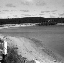
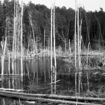
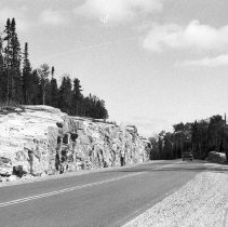
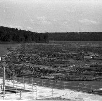
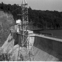
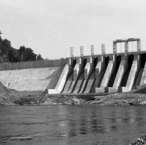
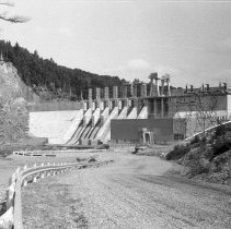
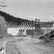
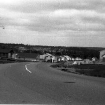
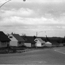
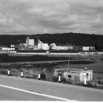
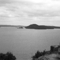
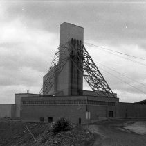
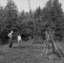
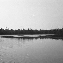
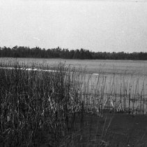
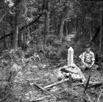
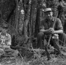
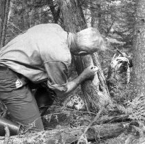
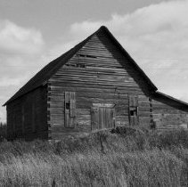
35 mm negative photographs taken by Bruce Krug and/or Howard Krug between 1961 - October 1961. Identification information below is taken from titles written by Bruce or Howard Krug on the negative envelope, next to negative numbers. [ ] indicates that identification was made based on appearance of image. Photograph List: K-61-04-01 Bridge at White Lake, west of White River, August 1961 K-61-04-02 Beaver Pond - Sault Ste. Marie to Port Arthur, August 1961 K-61-04-03 Sault Ste. Marie to Port Arthur, August 1961 K-61-04-04 Supply of pine logs for sawmill at Blind River. Logs above dam at Red Rock Falls, Red Rock Falls, August 1961 K-61-04-05 Power Dam at Red Rock Falls, Iron Bridge, Red Rock Falls, August 1961 K-61-04-06 Power Dam at Red Rock Falls, Iron Bridge, Red Rock Falls, August 1961 K-61-04-07 Power Project at Red Rock Falls on Mississogi River, Red Rock Falls, August 1961 K-61-04-08 Power Project at Red Rock Falls on Mississogi River, Red Rock Falls, August 1961 K-61-04-09 Housing Development, Elliot Lake, August 1961 K-61-04-10 Housing Development, Elliot Lake, August 1961 K-61-04-11 Deserted uranium mine, Quirke Lake Algom-Uranium Mine, Quirke Lake, July 1961 K-61-04-12 Looking south on Quirke Lake, 1961 K-61-04-13 Consolidated Donnison Shaft, Quirke Lake, July 1961 K-61-04-14 Clearing where Indian was found dead in Wigwam - near William Henry Marsh, near Tobermory, Howard Krug, Michael Ralph, Angus Ralph, Tobermory, 1961 K-61-04-15 William Henry Marsh, St. Edmunds Township, August 1961 K-61-04-16 William Henry Marsh, St. Edmunds Township, August 1961 K-61-04-17 Howard [Michael Ralph and Angus Ralph] at one of original survey markers - second survey marker is old stump, 1961 K-61-04-18 [Michael Ralph and Angus Ralph] by cedar stump mentioned in survey notes of 1855 as cedar tree, 1961 K-61-04-19 Howard Krug examining original survey marks placed on tree in 1855 near William Henry Marsh, 1961 K-61-04-20 Log church on Old Nipissing Road near Magnetawan, October 1961 |
Physical Description |
20 photographs : b&w negatives ; 35 mm |
Medium |
Negative |
Collection |
Krug family fonds |
Restrictions on Use |
Copyright has been transferred to the Bruce County Museum & Cultural Centre. |
Places |
St. Edmunds Township William Henry Marsh |
People |
Krug, Howard Henry Ralph, Angus Sinclair Ralph, Michael |
Search Terms & Subjects |
Surveying Wetlands |